Global Precipitation Maps History&Forecast
Get current, forecast and historical global precipitation weather maps with a 10 minutes-step via the easy-to-work API.
Features of Global Precipitation Map
-
This product includes two types of forecasts:
- Forecast for the next 6 hours for the US territory
- Forecast for the next 2 hours for other global areas
-
Historical weather map for the previous 2 days
-
Update period: every 10 minutes
-
Resolution: less than 1 km
-
Global coverage
-
Weather map layers: Precipitation layer
-
Weather sources:
Global Precipitatoin Map is based on global weather models, satellites, radars and our OWM NWP-ML technology.
-
There is the OpenWeather Interactive Weather Maps with Global Precipitation layer, which provide users with free access to visual data.
URL format and parameters
Use the following URL format and parameters to get weather maps. Please pay attention to the URL example.
API call
https://maps.openweathermap.org/maps/2.0/radar/forecast/{z}/{x}/{y}?appid={API key}&tm={date}
| Parameters | ||
|---|---|---|
{z} |
required | Number of zoom level The minimum value is 3, and the maximum value is 7 |
{x} |
required | Number of x tile coordinate |
{y} |
required | Number of y tile coordinate |
appid |
required | Your unique API key (you can always find it on your account page under the "API key" tab) |
tm |
required | Date and time of (Unix time, UTC), e.g. 1600782000.
To get historical data, please specify the date in the past in your API request. The date must be no earlier than 2 days ago from the current moment. To get current data, please specify the the nearest time in the past rounded up to 10 minutes |
Please pay attention to the points bellow to avoid possible errors:
- Please specify dates in all API requests.
- Please specify dates with 10 minutes steps. For example, 1600780200, 1600780800, 1600781400, etc.
- Please specify dates not earlier than 2 days from the current time and not later than 6 hours from the current time.
URL example
https://maps.openweathermap.org/maps/2.0/radar/forecast/6/13/24?&appid={API key}&tm=1600781400
You need to insert the generated URL into special plugins.
For example, Leaflet, OpenLayers. You can also use any other apps that support the display of layers. Learn more.
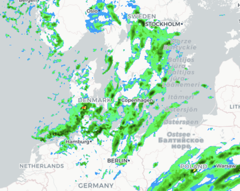
Example of Global Precipitation Map layer
Please find below Global Precipitation Map layer example.
URL example to the timestamp in the past
https://maps.openweathermap.org/maps/2.0/radar/forecast/7/4/2?&appid={API key}&tm=1703235600
URL example to the timestamp in the future
https://maps.openweathermap.org/maps/2.0/radar/forecast/7/4/2?&appid={API key}&tm=1703241000
Libraries to connect weather layers
Open Layers
The following functions are available for the OpenLayers library:
- Classes of weather layer and weather stations layer
- Possibility to set your own style
- Classes with clustered markers
- Support of marker server clustering
Leaflet
The OpenWeatherMap javascript library is designed to work with the Leaflet mapping service. The current version of the library allows the following:
- Embedding of layer with current weather in cities
- Embedding of layer with weather stations
- The library supports customer clustering


